In the Quarters of Kruununhaka
Kruununhaka • from 17 September onward • Free entry
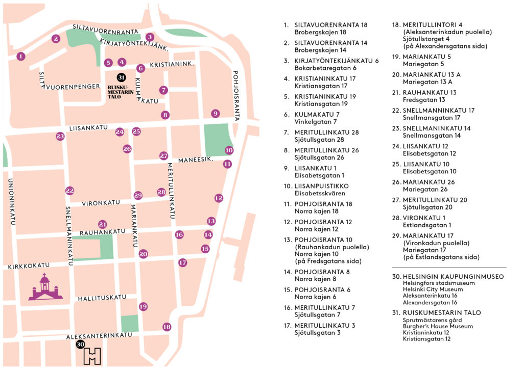
The photographic exhibition In the Quarters of Kruununhaka provides a glimpse into the life and history of the district over a period of about 100 years. The exhibition is on display on electrical cabinets in Kruununhaka. You can see the locations of the cabinets on the map on this page.
Helsinki City Museum has produced the In the Quarters of Kruununhaka exhibition on electrical cabinets as part of the OmaStadi project. OmaStadi is Helsinki’s way of implementing participatory budgeting together with the residents. Some of the photographs in the exhibition were featured in the vote held in July 2020. The permanent exhibition consist of 29 photographs. Most of the photos are from the collections of Helsinki City Museum.
The images in the exhibition are nostalgic snapshots of the history of the district and changes in the urban environment. You can navigate from one electrical cabinet to another with the help of the map and start your tour in the location of your choice. You can find the map on this page or collect a paper version at the information desk in the lobby of the City Museum during its opening hours (Aleksanterinkatu 16).
Click to enlarge »
Cabinet locations:
1. Siltavuorenranta 18 – Brobergskajen 18
2. Siltavuorenranta 14 – Brobergskajen 14
3. Kirjatyöntekijänkatu 6 – Bokarbetaregatan 6
4. Kristianinkatu 17– Kristiansgatan 17
5. Kristianinkatu 19 – Kristiansgatan 19
6. Kulmakatu 7 – Vinkelgatan 7
7. Meritullinkatu 28 – Sjötullsgatan 28
8. Meritullinkatu 26 – Sjötullsgatan 26
9. Liisankatu 1 – Elisabetsgatan 1
10. Liisanpuistikko – Elisabetsskvären
11. Pohjoisranta 18 – Norra kajen 18
12. Pohjoisranta 12 – Norra kajen 12
13. Pohjoisranta 10 (on the Rauhankatu side) – Norra kajen 10 (på Fredsgatans sida)
14. Pohjoisranta 8 – Norra kajen 8
15. Pohjoisranta 6 – Norra kajen 6
16. Meritullinkatu 7 – Sjötullsgatan 7
17. Meritullinkatu 3 – Sjötullsgatan 3
18. Meritullintori 4 (on the Aleksanterinkatu side) – Sjötullstorget 4 (på Aleksandersgatans sida)
19. Mariankatu 5 – Mariegatan 5
20. Mariankatu 13 A – Mariegatan 13 A
21. Rauhankatu 13 – Fredsgatan 13
22. Snellmaninkatu 17 – Snellmansgatan 17
23. Snellmaninkatu 14 – Snellmansgatan 14
24. Liisankatu 12 – Elisabetsgatan 12
25. Liisankatu 10 – Elisabetsgatan 10
26. Mariankatu 26 – Mariegatan 26
27. Meritullinkatu 20 – Sjötullsgatan 20
28. Vironkatu 1 – Estlandsgatan 1
29 Mariankatu 17 (on the Vironkatu side) – Mariegatan 17 (på Estlandsgatans sida)
Images:
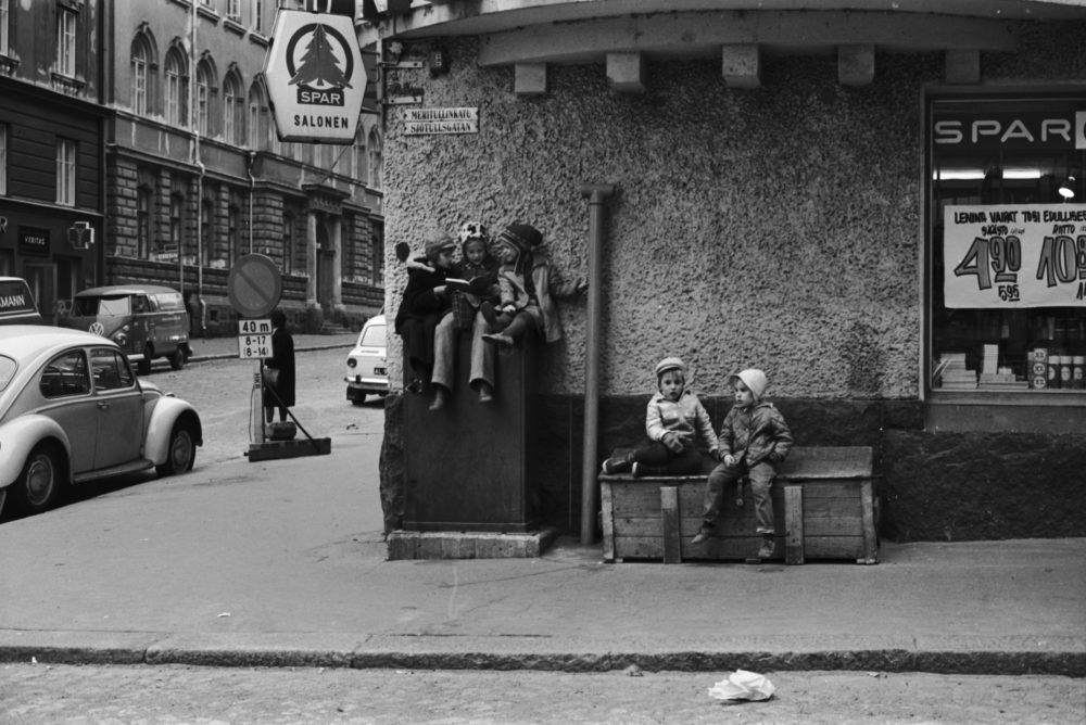
Three girls reading on top of a distribution cabinet at the corner of Meritullinkatu and Liisankatu. Two children sit next to them on a wooden crate. Grocery shop Spar Salonen on the corner, with Lenina nappies advertised in the window. Image: Eeva Rista / Helsinki City Museum. Date: October 1970.
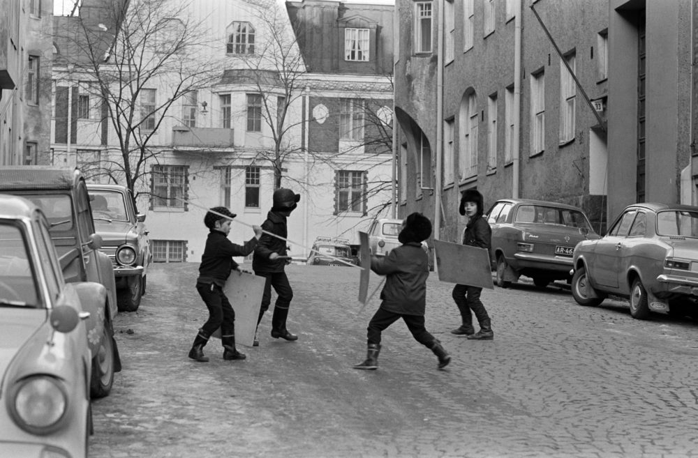
Four boys fencing with sticks and shields at the end of Meritullinkatu. Meritullinkatu 32 to the left and Meritullinkatu 33 to the right. Kristianinkatu 7 in the centre. Image: Eeva Rista / Helsinki City Museum. Date: January 1971.
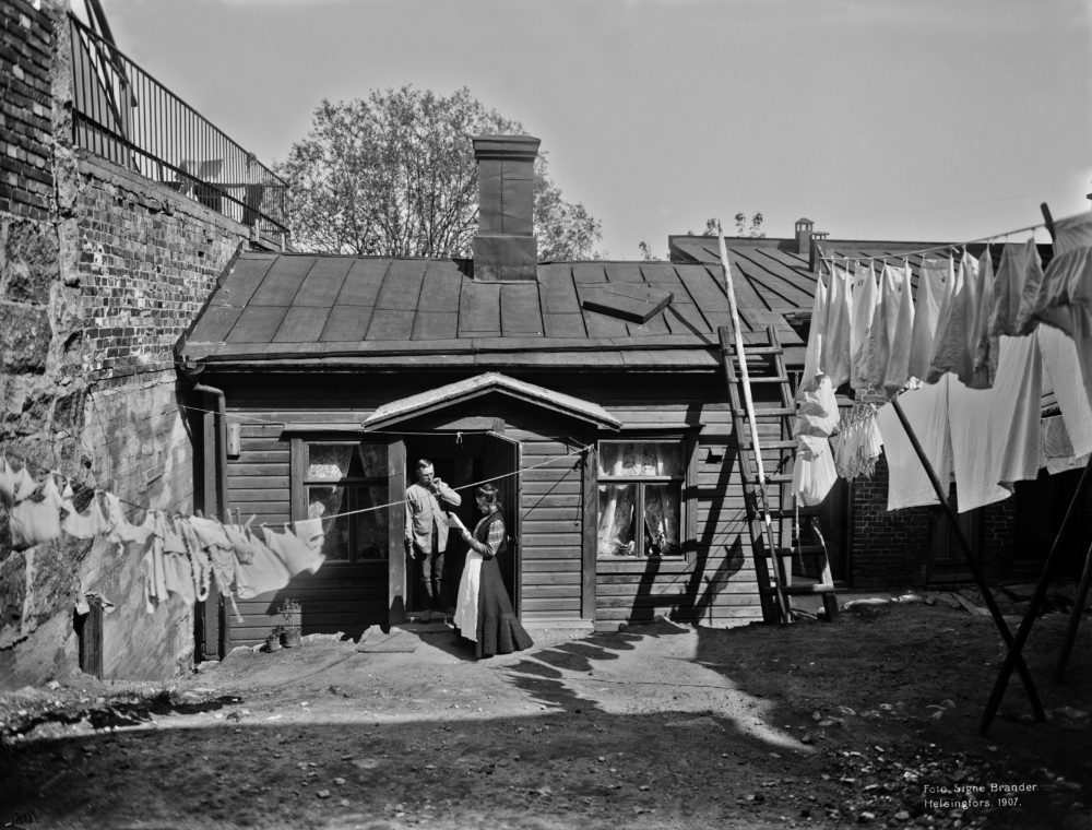
Kristianinkatu 15, in the courtyard. Image: Signe Brander / Helsinki City Museum. Date: 1907.
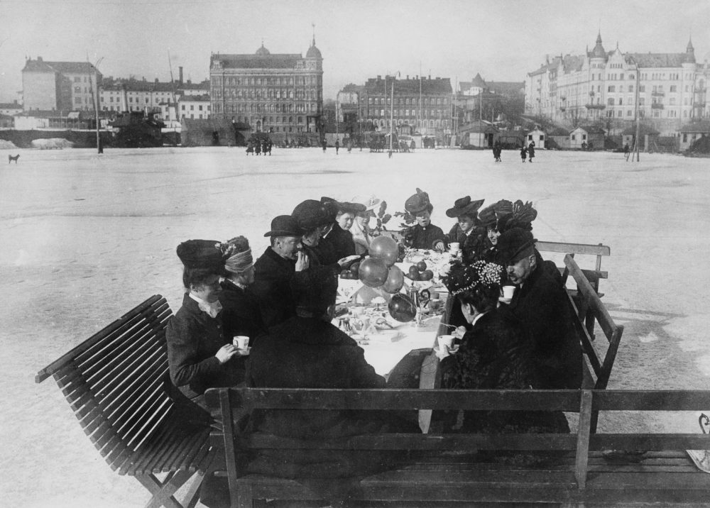
Ice skaters having coffee at the ice rink in North Harbour (Helsingfors Skrinnskoklubb). Borgström’s tobacco factory buildings, the palatial Standertskjöld house and the Bäck house in the background on the left and Pohjoisranta 10 with its towers to the right. Photo: unknown / Helsinki City Museum. Date: 1906.
